
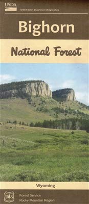
BIGHORN NATIONAL FOREST MAP
NATIONAL FOREST SERVICE - ROCKY MOUNTAIN REGION
Located in north-central Wyoming, the Big Horn Mountains are a sister range of the Rocky Mountains. Conveniently located half-way between Mt. Rushmore and Yellowstone National Park, the Big Horns are a great vacation destination in themselves. No region in Wyoming is provided with a more diverse landscape -- from lush grasslands to alpine meadows, from crystal-clear lakes to glacial carved valleys, from rolling hills to sheer mountain walls. Visit the Bighorn National Forest and enjoy the multiple reservoirs, 32 campgrounds, 3 scenic byways, 14 picnic areas, 7 lodges, miles and miles of streams, 189,000 acres of Wilderness, 1,500 miles of trails, and much more that provide a forest experience unique to the Big Horns.
Includes elevation ranges from 5,500 feet to a high of 13,167 feet at Cloud Peak. Waterproof and tear resistant material Highlights recreation opportunities such as trails, campground, boat launches, and more Includes official US Forest Service district office contact information to check local conditions as well as township and range section numbers Land ownership boundaries (federal, state, private) are color coded
- Two-sided, self-cover, recyclable mixed paper folded map.
- Scale - 1/2" = 1 mile (1:126,720)
- Shaded Relief - Yes
- Topo Lines - No
- Folded Dimensions: (L" x W" x D") 9 x 4 x .125
- Unfolded Dimensions: (L" x W") 40 x 27
- Printed in the U.S.A.
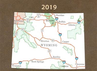
PUBLISHED: 2019
ISBN: 9781628111163