- ACCESSORIES
- >
- AVENZA GEO CT - FULL TRAIL MAP - SET OF 3
AVENZA GEO CT - FULL TRAIL MAP - SET OF 3
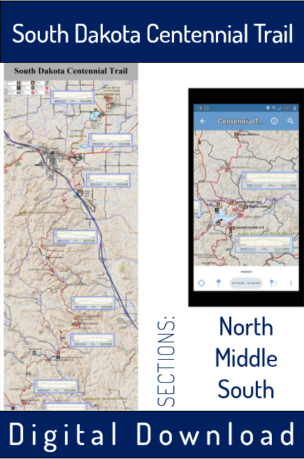
Digital Download of Full-Length Interactive GEO Map of SD Centennial Trail.
A collection of three maps that automatically updates your location while hiking the South Dakota Centennial Trail (#89).
These maps, when used with the Avenza Map App, allow you to follow the CT while knowing your exact location and recording your progress, alongside detailed trail information for the entire 124 miles of the South Dakota Centennial Trail (+40 additional trails in the area).
Map can be used with either Android or Apple phones and tablets and must be used with the Avenza Map App (paid or free version)
[FEATURES]
- Works only on mobile device with use of Avenza Map App -- map is not functionally printable
- 72 pixels/inch (phone/tablet)
- Maps shows trailheads, water locations, legal camping spots, horse camps, food accessibility, mile-markers
- Northbound (NOBO) narrative of 124 cumulative miles
- Emergency routes at French Creek & Elk Creek
- Cumulative and section miles
- Section elevation profiles + time estimates
- Points of interest & scenic spots as in book narrative & Shan's 'cheat sheet'
- Shows all crossing and nearby trails
- 40 additional trails in the area including Sturgis Trail System, Black Elk Wilderness Trails, Wind Cave Trails + more
Purchase is only good for SINGLE download of each map in bundle to be used within the Avenza Map App.
Detailed instructions on how to add maps to the app are included with purchase.
FOR COMPANION CENTENNIAL TRAIL GUIDEBOOK, CLICK HERE
FOR MORE INFORMATION ON THE SD CENTENNIAL TRAIL, CLICK HERE
FOR INFORMATION ON SHUTTLE SERVICES, CONTACT THE STORE BY EMAIL OR PHONE


